An Apple office in Hyderabad, India is devoted to Maps
Sign up to our free weekly IndyTech newsletter delivered straight to your inbox
Sign up to our free IndyTech newsletter
After a start rockier than most of the terrain it covered, Apple’s Maps app has changed out of all recognition. Is it worth using now?
When Apple Maps replaced Google Maps as the iPhone’s default mapping app in autumn 2012, it wasn’t an unqualified success. Though the maps themselves were attractive, and extra features like Flyover with indepth 3D renders were well-liked, there were lots of problems.
A farm called Airfield in Ireland was labelled as an airport, leading to fears of planes trying to land there.
And the UK’s biggest tourist magnet outside London, Stratford-upon-Avon, went missing altogether.
Things improved rapidly with errors corrected, reliability improved and points of interest data freshened up.
Last autumn, with the arrival of iOS 10, the app was redesigned again, though with so many other elements in the software, Maps was easily overlooked.
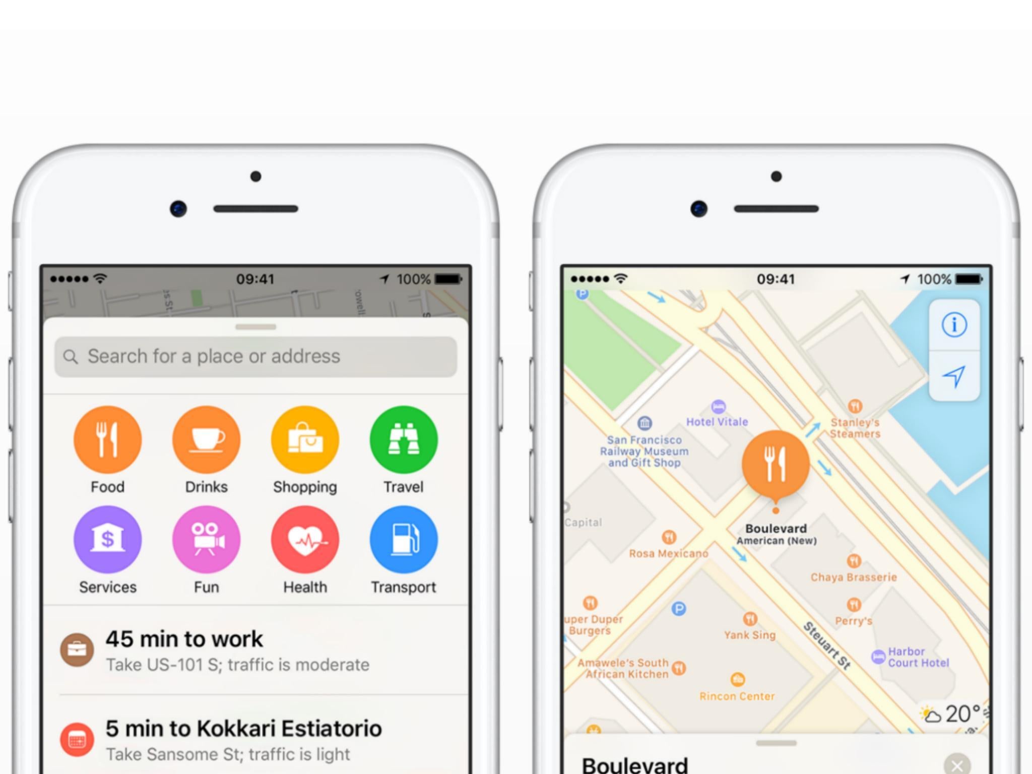
Well, now it’s really finding its feet. It’s the most frequently used mapping app on iOS, more than all the other apps combined. An Apple office in Hyderabad, India is devoted to Maps, keeping it current, correcting mistakes and adding features.
So there are now 150 different icons for points of interest, from a beer glass for bars, a knife and fork for restaurants and so on. They’re colour-coded (food and drink-related items are orange), and there are even localised icons for landmarks in various cities to help you find, say, the Gherkin in London or the Statue of Liberty in New York to help you recognise them when you’re in the vicinity.
There are other cute extras, such as the fact that in the UK, Flyover mode shows the giant rotating viewing platform that is the London Eye actually rotating – though rather faster than the real thing does.
Its transport coverage improves continually, now including the Santander Cycles bike hire scheme in London, for instance.
And you can book a table at lots of restaurants right from the app, including Michelin restaurants in London, such as Aqua Shard and Sketch.
It’s still not perfect: you need a data connection for it to work and, if you’re using it overseas – where maps are perhaps most useful – you risk racking up hefty data roaming charges.
Here Maps, originally from Nokia and now rebranded as Here WeGo, allows users to download entire country maps (or state by state in the US, for instance) in advance, for free, so you can use many of the features without turning on data roaming or if you hit an area with no phone signal. You don’t get live traffic updates, obviously, but the mapping is good and is searchable offline.
And Google Maps lets you download mapping for the area you’re in. This was complicated to do but is now much simpler, requiring two taps, one of the menu button and then the words Offline Maps.
It’s a feature that Apple’s own Maps could do with, but for now the app is so much improved that, if you’ve shied away from it because of its previous disappointments, it’s worth taking a second look now.
Join our commenting forum
Join thought-provoking conversations, follow other Independent readers and see their replies

Join our commenting forum
Join thought-provoking conversations, follow other Independent readers and see their replies