The ensuing travel chaos is expected to affect millions of commuters, bringing London to a standstill in a similar fashion to the July strike – the largest in 13 years.
During that strike hundreds of thousands of commuters were spotted walking, running, and cycling to and from work. This map will undoubtedly prove helpful.
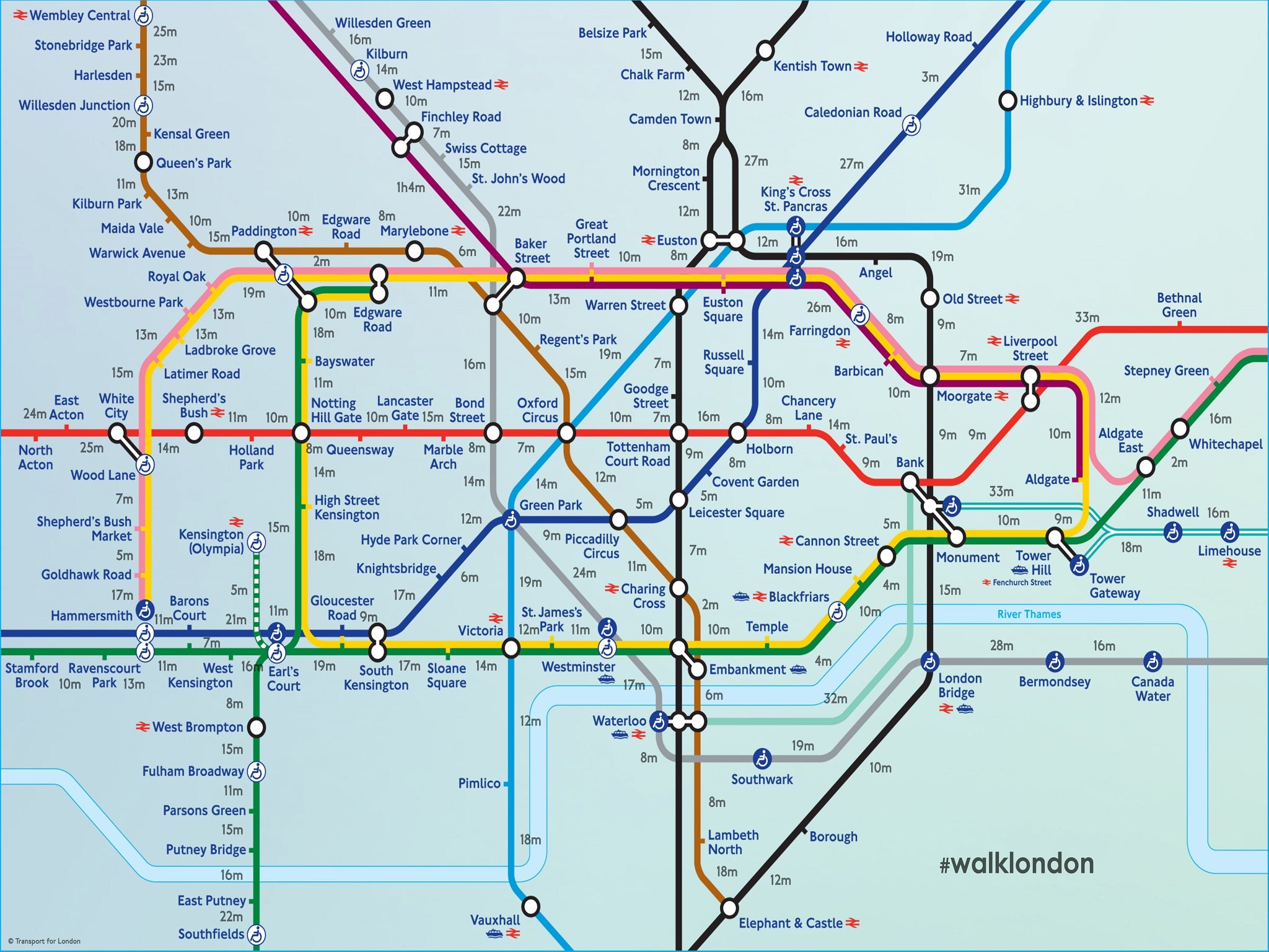
Londoners Joe Watson and Aryven Arasen, who both work in advertising, created the map ahead of the industrial action in 2013.
In pictures: Tube strike in London (July 2015)
Show all 12
North London residents may face the worst walk, as with the usually quick Victoria line down they face a 31-minute trudge between Highbury& Islington and Kings Cross.
Another great stretch is Bermondsey to London Bridge, where commuters face a half-hour walk.
Join our commenting forum
Join thought-provoking conversations, follow other Independent readers and see their replies


Join our commenting forum
Join thought-provoking conversations, follow other Independent readers and see their replies
Comments