Free sat-nav apps: What’s the best free navigation app for your smartphone?
Free up-to-date guidance has never been more ava

Stay ahead of the curve with our weekly guide to the latest trends, fashion, relationships and more
Stay ahead of the curve with our weekly guide to the latest trends, fashion, relationships and more
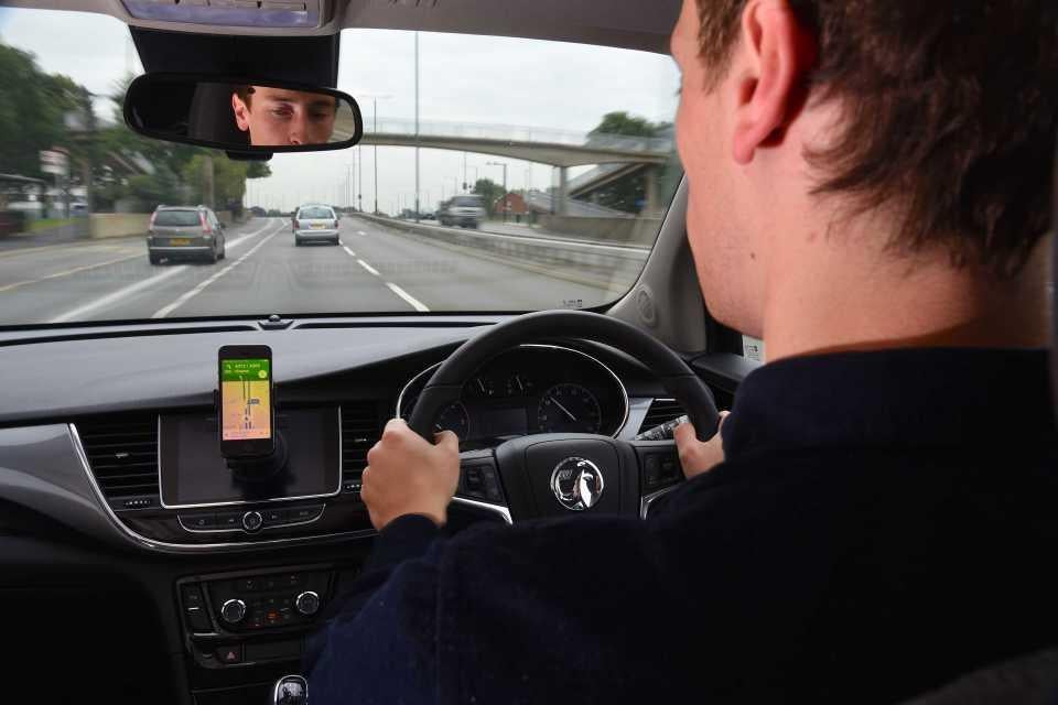
The advantage of the sat-nav app is that, with a few taps and swipes, real-time traffic and route information can be freely available to those with a smartphone.
They’re fast overtaking the quick-to-age inbuilt car systems, and they cost nothing, but how do they compare against each other?
In urban and rural areas within the UK we tested a selection of six free sat-nav apps currently available on Android, iPhone and Windows platforms.
App CoPilot GPS (2 stars)
Available on iOS, Android
The app works well in offline mode, though, and you can pay for extra features like voice-guidance, full automatic navigation and 3D maps.
It’s simple to set up and the layout is uncomplicated but we found that the app has a default mode in which the screen view is too zoomed out. Zooming in is no issue, but should you tap a shortcut and return to the original screen you have to reset the zoom-in facility manually each time. Not ideal while driving.
It also needs precise destination input to operate, which again is not always convenient for those in a hurry.
App Navmii (3 stars)
Available on iOS, Android, Windows
This free version of Navmii also gives real-time traffic and hazard information. Screen and directions are clear and easily navigable, though estimations of city arrival times can be less than accurate.
The input of fellow app users notifying you of events as they happen is a big plus, but the adverts that come in until you begin your journey are not. They restrict your view of the screen. You can pay a little extra for the advert-free version and also for the addition of speed camera location alerts.
Navmii’s facility to download more maps (Europe and world), is worthwhile if you need them. Some of these are free too but may have a payment requirement for ‘upgrades’, as we found with this model.
App Google Maps (4 stars)
Available on iOS, Android
This is the one we’re most familiar with for guidance, whether you’re on foot or wheels. It doesn’t disappoint. It’s clear to view and simple to set up and use with a few extra features that you don’t pay extra for.
Scanning of destinations can be approximate or specific without it throwing a paddy. Planning of long or short journeys, with or without additional stops, is a doddle. Tuning in while abroad is stress-free and familiar. The biggest ‘but’ is the fact that data can be eaten up if you don’t keep an eye on it (as well as the road).
App GPS Navigation by Scout (SatNav) (2 stars)
Available on iOS, Android
Clear to read layout and directions if you stay on the route it allocates. Adding or altering requirements can be tricky, particularly when under pressure.
It has a useful feature whereby it can locate your car for you (this I like after flashbacks of trawling Knebworth’s carpark for 3 hours in 1996). Destination estimation times in cities can be too loose for comfort and routes are not always wisely chosen.
App Here WeGo (3 stars)
Available on iOS, Android
Given that the company Here is behind the majority of in-car nav systems you would think they have the ideal product. For the most part, they do: they have transferred their spec onto a smartphone app effectively, with a couple of bells and whistles other manufacturers expect payment for.
WeGo is intuitive, simple to set up, use and follow. It shows parking locations, and includes real-time traffic information with an alternative satellite view facility. This feature comes in handy if you’re needing to recognise and tally landmarks when the city route mapping isn’t precise.
App Waze (4 stars)
Available on iOS, Android
This is a more interactive app whereby drivers can ‘like’ or ‘dislike’ warnings designed to keep traffic situations up to date and accurate. It even lets you know what the incident may be; whether it’s an accident or a cow in the road, you’ll know.
Interactive input is surprisingly easy to do even while on the move, building route knowledge and helping you to make the right choices.
Waze was the most accurate for arrival times of all on test, probably due to this continual and comprehensive updating of real-time traffic information both by the manufacturer and by fellow users.
The extra features are on the house and include the ever helpful ‘Where is my car?!’ that some of us covet. The screen layout is user friendly and the routes clear to read.
Conclusion:
1. Waze
2. Google Maps
3. Here WeGo
Despite their established techno input in the world of motoring navigation, Here We Go slots in at third. Their routes are accurate and nicely laid out but their destination arrival times are not so reliable.
Second is Google Maps, everybody’s go-to aid. It’s familiar, simple and accurate but in this case not quite motoring-specific enough.
First choice for us was the Waze app with its driver-friendly features. While it’s not perfect, it’s the simplest to use and the up to date feedback interactivity gives it the capacity to revolutionise journeys and reduce blood pressures by allowing drivers to arrive at accurately-calculated times.
What Car?
Subscribe to Independent Premium to bookmark this article
Want to bookmark your favourite articles and stories to read or reference later? Start your Independent Premium subscription today.
Join our commenting forum
Join thought-provoking conversations, follow other Independent readers and see their replies